
News
Gallery Features Map Art by MLA Students
-
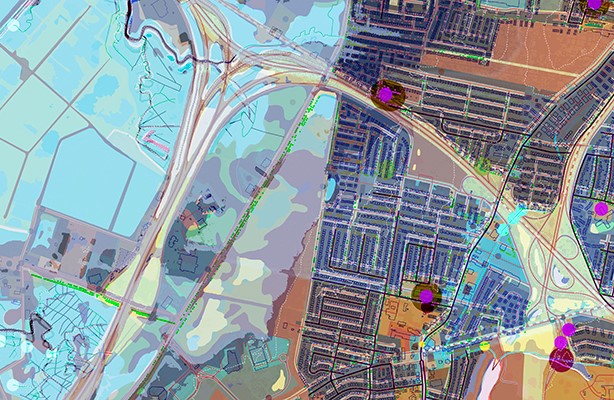
Working detail from The Forgotten Borough, 2017, by Jacqui LeBoutillier, Robynne Heymans, and Sarah Toth.
Work by Master of Landscape Architecture second-year students Robynne Heymans, Jacqueline LeBoutillier, and Sarah Toth is featured in Map and Territory at Shoestring Studio in Crown Heights, Brooklyn. The exhibition of maps charts both imagined space and fragmented, distorted real geography.
According to their project statement, maps are misleading, overly reductive, particularly when it comes to cities. This series tests this idea by compiling publicly available geospatial data into a collection of dense maps, drawings, and models in the hope to reveal urban complexity. Illegible, hardly recognizable, the results question the limits of mapping and data. Viewing data at a single projection or scale does not truly reveal the character or complexity of place. Staten Island, “The Forgotten Borough,” is a prime example of how reliance on planar representation can distort how community, ecology, and infrastructure interact on the ground.
The show opened on March 24 and runs until April 16.